Hiking in the woods
Ano Chora has rich and varied flora, with abundance of pine and chestnut trees, considering that Mountainous Nafpaktia has a multitude of watersprings. The forest around the village is thick and all green. Walking through the trees you can enjoy breathtaking landscape with headen beauties. The lucky ones will see squirrels, hares and foxes. All kinds of wildlife finds selter in the forest wild boars, deers and others.
Down below you will find information on proposed hiking trails. Don’t hesitate to contact us for more information.
Kakavou Gorge
The path of Kakavou is also known by the people in the area by the name Hercules Path. Research by Patras University has shown that Hercules took this path coming from Ancient Plevrona (nowdays known as Mesologgi) to get to Evia Island to wed Dienera daughter of Plevronous.
The route starts from Ano Chora towards the village of Ambelakiotissa where you can find the Historical Old Church with the same name. The route takes about 3 hours at a leisurely pace through pines, chestnut trees, cedars, holm oaks and willow trees. The route is of moderate difficulty and it is not for children.
More information and map


Tsourna Waterfalls
A lovely route through the forest extending for 3 km with a leisurely pace it will take you about 2 hours.
more information and map
Ano Chora – Tsakalaki
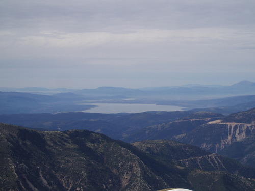
From the square and walking up through the streets of Ano Chora we get to a dirt road at the top overlooking the village. We follow the dirt road on the right passing by two watersprings () and stone icon. Going by a chestnut tree field and continuing steadily North East we leave the dirt road. Walking for 100m we find a crossroad and we choose the left dirt road following it for about 200 metres. Again on the left of the dirt road we enter a not so ovious path for another 200m. Getting to a new road we can see Tsakalali Peak following the route for 950 metres we get to a crossroad we choose the right uphill dirt road until its end, ending up at some sheep shades. Going uphill from there with no visible path and with considerable difficulty we get to a clearing 80 metres under the first peak (1697 metres). Walking by the first peak following the mountain range we get to Tsakalaki. We have a breathtaking view of the Mountains of Nafpaktia, Vardousia also Mountains of Evritania and Trichonida.
more information and map

 Ελληνικά